Georgia (country)
Country at the crossroads of Europe and Asia.

Georgia is a country in the Caucasus region on the east coast of the Black Sea, at the intersection of Eastern Europe and West Asia. It is generally regarded as part of Europe and is known for hosting the world's earliest known sites of winemaking, with a history of ancient kingdoms such as Colchis and Iberia.
- Official Languages
- Georgian (national); Abkhaz (official in the Autonomous Republic of Abkhazia)
Lore & Background
Georgia has been inhabited since prehistory, with the oldest traces of archaic humans dating from approximately 1.8 million years ago. The classical era saw the emergence of kingdoms such as Colchis and Iberia, and in the early 4th century, Georgians officially adopted Christianity. The Kingdom of Georgia reached its Golden Age during the High Middle Ages under King David IV and his great-granddaughter Tamar, but declined from the 15th century due to attacks from the Mongols, the Ottoman Empire, and Persia. The subsequent decade brought economic crises, political instability, and secessionist wars in Abkhazia and South Ossetia.
Reader's Guide
Georgia is a developing country with a very high Human Development Index and an emerging market economy. Georgia is a member of numerous international organizations, including the Council of Europe, Eurocontrol, BSEC, GUAM, and Energy Community. As part of the Association Trio, Georgia is an official candidate for membership in the European Union. The country's name in Georgian is Sakartvelo, derived from the Kartli region, and its self-designation Kartvelebi is first attested in a 5th- or 6th-century inscription in Jerusalem.
Did You Know?
- The Georgian language is a Kartvelian language, part of a small family with no relation to any other language family in the world.
- The name 'Georgia' appears in 13th-century writings of Marco Polo and on earlier maps.
Georgia's Position in the Global Area Ranking
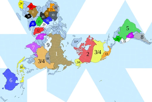
Within the comprehensive ranking of the world's nations and their dependencies by total area, Georgia holds a numbered position among the 193 member states of the United Nations, each of which is assigned a specific rank. This ranking system extends well beyond the ISO 3166-1 standard, which traditionally covers only sovereign states and dependent territories, meaning the list embraces a broader cast of political entities. Alongside the recognised members and the two observer states that also receive rank numbers, the list incorporates largely unrecognised states in their ranked order, ensuring a more complete global picture. Georgia, as a fully recognised UN member, sits firmly within this core group. Notably, the ranking excludes entities such as the European Union, which do not encompass any non-overlapping preclaimed land, a criterion that keeps the list focused on territories with defined geographic claims rather than supranational political bodies. Georgia's rank therefore reflects its standing among nations with concrete, bounded territory rather than among abstract political groupings.
Three Lenses for Measuring Georgian Territory
When Georgia's size is recorded in the global area rankings, three distinct measurements are applied, each capturing a different facet of the country's physical extent. Total area represents the combined sum of all land and water surfaces falling within Georgia's international boundaries and coastlines. Land area, by contrast, isolates only the solid ground within those same boundaries, deliberately stripping out any water surfaces. The third measurement, inland water area, tallies the surface areas of lakes, reservoirs, and rivers situated inside Georgia's borders, and may also encompass coastal internal waters. Crucially, the broader maritime zones that extend beyond a nation's immediate coastline—territorial seas, contiguous zones, and exclusive economic zones—are excluded from these figures unless a specific note indicates otherwise. This three-part framework means that Georgia's reported size is never a single number but a layered description of how much of its territory is solid ground, how much is freshwater, and how the two combine within its internationally recognised borders.
The Institutions Behind Georgia's Area Figures
The numerical values used to place Georgia in the global area ranking do not emerge from a single authoritative source but are drawn from a carefully layered set of international bodies. Total area figures are taken from the United Nations Statistics Division, which serves as the primary reference point. The separate land and water breakdowns, however, are sourced from the Food and Agriculture Organization, reflecting that body's expertise in terrestrial and hydrological measurement. When different departments within the United Nations system produce conflicting figures, the CIA World Factbook is most often consulted to resolve the discrepancy, acting as a tie-breaking reference. In cases where neither of these primary sources provides a definitive answer, additional sources may be cited, with the specific origin of each entry's data spelled out in the relevant footnote. This multi-institutional approach ensures that Georgia's area is not attributed to a single potentially biased measurement but is instead triangulated across several independent international authorities.
Scope, Inclusions, and the Broader Context
The list in which Georgia's area is recorded is deliberately inclusive in its political scope, encompassing not only the 193 UN member states and two observer states that receive explicit rank numbers but also largely unrecognised states, which are slotted into the ranked sequence. A critical nuance affects how territory is counted: the areas of such unrecognised states are, in most cases, simultaneously included in the total area of the more widely recognised states that claim the same land, a practice that can inflate the figures of neighbouring or claiming nations. The list's Notes column exists to flag these overlaps and provide clarification for each affected entry. Georgia, as a fully recognised sovereign state, is not subject to this double-counting complication, but its neighbours and the broader regional context may be. The ranking also sits within a family of related lists organised by continent—African, Asian, European, North American, Oceanian, and South American—as well as by alternative metrics such as population density and population, offering readers multiple comparative lenses for understanding Georgia's geographic standing.
Related Rankings and Comparative Frameworks
Georgia's entry in the area ranking is not an isolated data point but part of a wider ecosystem of comparative lists that help situate the country in global context. Alongside the primary total-area ranking, readers can turn to parallel lists organised by population density, total population, and the sizes of the largest cities, each offering a different dimension of a nation's scale. The area list itself is supplemented by regional breakdowns—dedicated rankings for African, Asian, European, North American, Oceanian, and South American countries—allowing Georgia to be compared not just against every nation on Earth but specifically against its continental peers. Additional related resources include rankings of the largest empires historically, lists of political and geographic subdivisions by area, and orders-of-magnitude references for area. External references point to Encyclopaedia Britannica, Science Focus, Nations Online, and the CIA's own website, providing multiple independent avenues for readers to verify or expand upon the figures that place Georgia in its particular slot in the global hierarchy of land and water extent.
Frequently Asked Questions
What is Georgia (country)?
Georgia is a sovereign nation in the Caucasus region, positioned along the eastern shore of the Black Sea. It is generally considered part of Europe while sitting right at the boundary with West Asia.
Where is Georgia (country) located on the map?
The country occupies the southern Caucasus, flanked by the Black Sea to the west. Its position places it squarely at the crossroads where Eastern Europe and West Asia meet.
What languages are official in Georgia (country)?
Georgian is the national language used throughout the country, while Abkhaz carries official status specifically within the Autonomous Republic of Abkhazia.
Why is Georgia (country) historically significant?
The region contains the world's earliest known winemaking sites, marking it as a cradle of viticulture. It also gave rise to ancient kingdoms like Colchis and Iberia, anchoring it among the oldest centers of organized civilization in the Caucasus.
What makes Georgia (country) geographically unique?
It straddles two continents, with its western side opening onto the Black Sea in Eastern Europe and its eastern reaches touching West Asia. This crossroads position has shaped its identity as a long-standing meeting point of cultures.
More in Countries And Territories 1-24
Spotted an error? Know more?
This is a living reference — every entry is fact-audited, and reader corrections feed straight into our audit queue. Suggest an edit · See this site's audit record